Explore the South Bay | Bay Day 2021
Bay Day Regional Spotlight

Brought to you by Facebook, weekly regional spotlights give an in-depth look at the Bay Area. From trails and activities to inspire your Bay Day Trail Challenge adventures, to partners and locations vital to Save The Bay’s mission of creating a healthy and resilient Bay – discover what makes our region so special, and so important to protect.
Don’t forget to follow us on Instagram and Facebook and share your adventure with #BayTrailChallenge #SFBayDay and tag @saveSFbay for the chance to win a $50 REI gift certificate every week in October.
Discovery Guide
Trails
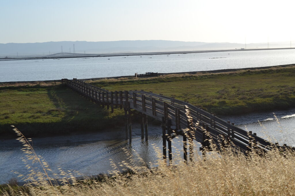
Bedwell Bayfront Park to Alviso
This trail begins at Bedwell Bayfront Park, heading southward into the Don Edwards San Francisco Bay National Wildlife Refuge and finishing at Alviso Marina County Park. From here you can explore the Ravenswood Open Space Preserve, discover the Lucy Evans Baylands Nature Interpretive Center, and visit the nearby Sunnyvale Baylands Park which features seasonal wetlands and grassy uplands that are great for picnicking. →
Alviso is a historic waterfront town in the city of San Jose, located at the southernmost part of the Bay. The former marina has been restored back into wetlands and houses a variety of trails. As you explore you can see wetlands, brackish and freshwater marshes, and salt ponds. The nearby Environmental Education Center off of Grand Boulevard exhibits some interpretative displays of wetland wildlife and has its own 4.5 mile loop trail surrounding a restored salt pond. →
Activities
Learn more about the wildlife that you can find in the Bay Area through Save The Bay’s Summer Camp activities.
Summer camp activities are a part of OLO: Outdoor Learning Online, Save The Bay’s education portal that offers hands-on science lessons for remote learning environments.
South Bay Shoreline Study
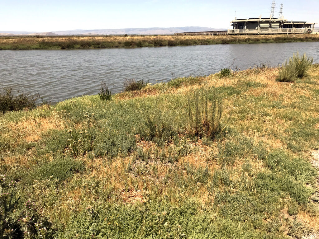
The South Bay has some of the most incredible access to the Bay shoreline, as the Bay Trail snakes along the levees ringing former salt production ponds that now comprise the Don Edwards National Wildlife Refuge. Many of the ponds just north of San Jose are also part of an ambitious flood protection and habitat restoration project called the South Bay Shoreline Study. Despite its unassuming name, the Shoreline Study is a critical component of the South Bay’s future flood protection from storms and sea level rise. Many of the surrounding communities, particularly Alviso in San Jose, are subject to flooding, and with sea level rise the risk from the Bay is increasing.
The Shoreline Study will build new levees and restore nearly 3,000 acres of former salt ponds into tidal marsh and other natural habitat to buffer Alviso and North San Jose from the Bay’s rising waters. Together with the larger South Bay Salt Ponds Restoration Project, the largest tidal wetland restoration project on the west coast, these two efforts will remake the area’s landscape to provide habitat for endangered species, flood and storm surge protection for residents, water quality improvements for the Bay, and more recreational access for people to experience and enjoy the natural landscape of our region.
With sea level rise from climate change already staring to show impacts locally, this is exactly the type of nature-based, multi-benefit climate infrastructure that Save The Bay works to support. In 2016, we led the campaign to pass Measure AA, a $500 million parcel tax that voters backed overwhelmingly to fund these types of restoration projects. That investment has already been put to work providing significant funding for the Shoreline Study, along with large contributions from the federal government, State Coastal Conservancy, and Valley Water. Save The Bay will continue to advocate for additional state and federal funding to accelerate these types of restoration and flood protection projects to keep our communities out of the reach of rising tides.
Making our Cities Resilient: San Jose Urban Greening
A day out walking along the Bay provides significant mental and physical health benefits. Unfortunately, the same isn’t always true within our cities where streets are built to prioritize traffic efficiency over pedestrian safety, and urban environments are dominated by hardscape rather than vegetation and natural features. In fact, walking or biking around many cities can be downright dangerous, especially in neighborhoods that have experienced historic patterns of disinvestment and lack access to political and economic power, which often fall along racial lines.
Climate change is making this situation worse. As average temperatures increase, areas without tree canopy and vegetation experience even higher heat – a situation called the “urban heat island” effect. Trees and other plants can help reduce the ambient air temperature in cities by up to 10 degrees, and pervious surfaces like tree wells, planter boxes, and bioswales can absorb and filter rainfall from the more intense storms that are predicted to occur. Doing so relieves pressure on stormwater systems that can get overloaded and lead to flooding, and stormwater filtered through these types of “green” infrastructure is cleaner – improving water quality in the Bay.
In San Jose, Save The Bay has been working over the past few years to prioritize equitable investment in “urban greening”, including expanded tree canopy, green streets, and other nature-based features. By doing so, we can make our communities more resilient to climate change and improve water quality in the Bay. If done as part of pedestrian-focused street redesigns, we can also ensure that our streets are safer, more appealing places for people.
A Long History of Restoration In Palo Alto
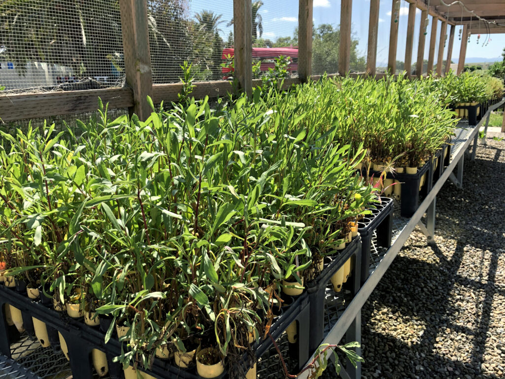
Save The Bay has worked in collaboration with the City of Palo Alto in the Baylands for over 20 years, initially establishing a restoration site at the mouth of San Francisquito Creek in 2001. That first season, we held 8 programs and planted over 10,000 plants grown by an outside native plant nursery contractor. In 2004 and with much celebration and fanfare, the City constructed the nursery shadehouse structure we still use today to grow our plants. Over the past two decades, the Baylands have been the site of innumerable education and community-based programs. We join together with the City of Palo Alto staff to restore the shoreline and educate the public about the importance of these critical tidal marsh habitats. This partnership not only gives us a home base from which to conduct our restoration and education work but provides vital support to both parties.
In the next few years, Save The Bay hopes to take our work with the City of Palo Alto even farther. We’ll apply what we’ve learned from our work on the Oro Loma Horizontal Levee demonstration project and apply it to similar multi-solution green infrastructure projects around the bay. A local example of this is the planned Palo Alto Horizontal Levee Pilot Project, undertaken by the City of Palo Alto, ESA, the SF Estuary Partnership and the EPA. Gently sloping, vegetated horizontal levees, like those designed in these two projects, generate greater benefits than a traditional hardened shoreline levee. They provide healthy, native transition-zone habitat, improve water quality, and serve as shoreline and flood protection in the face of sea level rise.
Meet the Environmental Volunteers
Environmental Volunteers (EVols) is an organization with a longstanding relationship to the Palo Alto Baylands and a mission similar to that of Save The Bay. Since 1972, EVols has provided hands-on science learning to students throughout the South Bay and strives to generate lifelong stewards of the natural world. The organization is housed in a unique building originally constructed in 1941 for the Sea Scouts program’s use in launching boats into the adjacent Palo Alto Harbor. In 1986, the City of Palo Alto chose to close the frequently dredged harbor, allowing it to return to its natural state of tidal marsh wetland. Today, the Baylands tidal marsh and transition zones are lush and verdant, providing critical habitat for migrating waterfowl and endemic species like the elusive Ridgway’s Rail.
Interested in volunteering with EVols? Check out their website or email volunteer@Evols.org.
Facebook’s Ongoing Committment to the Environment
Building on Facebook’s ongoing dedication to fighting climate change and their commitment to Bay Day as a title sponsor this year, they recently partnered with Midpeninsula Regional Open Space District to support a crucial effort to improve access to the San Francisco Bay Trail. This trail system is a central focus of Save The Bay’s 6th Annual Bay Day, and is planned to eventually include 500 miles around the Bay. Currently, 350 miles are in place and expansion continues as gradually the gaps between segments are filled in.
One such gap is the Ravenswood Bay Trail Connection, in East Palo Alto (near Facebook’s campus and one of Save The Bay’s habitat restoration sites). Closing this gap was a priority since it opened 80 miles of continuous Bay Trail, connecting to Menlo Park to the north, the Santa Clara area to the south, and across the Dumbarton Bridge to the East Bay. Completed in 2020, the new segment enables more people to commute by bicycle and offers new options for recreation.
Facebook has been instrumental in ensuring this vision will become a reality—one that will connect more Bay Area residents now, and far into the future, with the natural environment and with our spectacular Bay.