Brought to you by Facebook, weekly regional spotlights give an in-depth look at the Bay Area. From trails and activities to inspire your Bay Day Trail Challenge adventures, to partners and locations vital to Save The Bay’s mission of creating a healthy and resilient Bay – discover what makes our region so special, and so important to protect.
Don’t forget to follow us on Instagram and Facebook and share your adventure with #BayTrailChallenge #SFBayDay and tag @saveSFbay for the chance to win a $50 REI gift certificate every week in October.
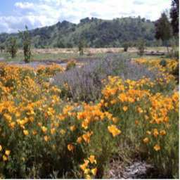
Northern Vallejo to Napa is a 37.2 mile moderate trail that features a river and is great for hiking and cycling. This trail is part of the California Department of Fish and Wildlife’s 1,400-acre Napa Plant Site Restoration Project. As you head into Napa County, the Wetlands Edge Bay Trail provides a bevy of birds and expansive marsh views. Nearby, there is also the Napa Valley Vine Trail, a planned 47-mile walking and cycling path. →
This trail is a 17.9 mile moderately-rated path between Point Wilson and Carquinez Bridge. When completely finished, the trail will one day encircle the entire Carquinez Strait. For now, walk along the Carquinez Strait Regional Shoreline for spectacular views of the Strait with boats cruising through the Strait, trains running along the shore, and hawks flying overhead. This path will also take you into Benicia State Recreation Area, which connects to Glen Cove Waterfront Park. →
Check out our OLO Ecosystem Explorer video to learn how to identify and explore different types of ecosystems around San Francisco Bay. →
Download our Ecosystem Explorer Guide and explore an open space near you. Use this activity worksheet to make observations, collect evidence of biotic and abiotic factors, and create your own guide.
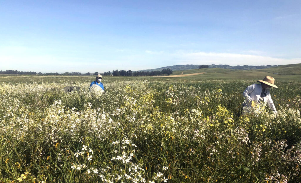
Meet the Novato Baylands Stewards
Collecting native annual seed with NBS in spring 2020
Novato Baylands Stewards (NBS) was founded in 2019 after nearly 10 years of dedicated restoration and stewardship of the Hamilton Wetlands Restoration Project. Previously the Hamilton Army Airfield, U.S. Congress authorized the Hamilton Wetland Restoration Project (including the NAF) in 1999, which in addition to the Bel Marin Keys Wetland Restoration Project comprises 2,600 acres of habitat. When complete, these tidal and seasonal wetlands will better support native bird and animal species, provide shoreline protection, and recreational opportunities to the north bay.
At the helm of NBS is Christina McWhorter, an ecologist and environmental educator with a passion for hands-on work and bringing the community together to restore wetland habitat. Christina founded the Novato Baylands Stewards with the support of MarinLink (a 501c3 organization) in an effort to continue the critical work being done around the Novato Baylands. In addition to Christina, the NBS is made up of two staff members, seasonal work training crews, and a team of dedicated volunteers who are involved in all aspects of restoration work – from vegetative monitoring to invasive species removal to repairing the occasional water control structure.
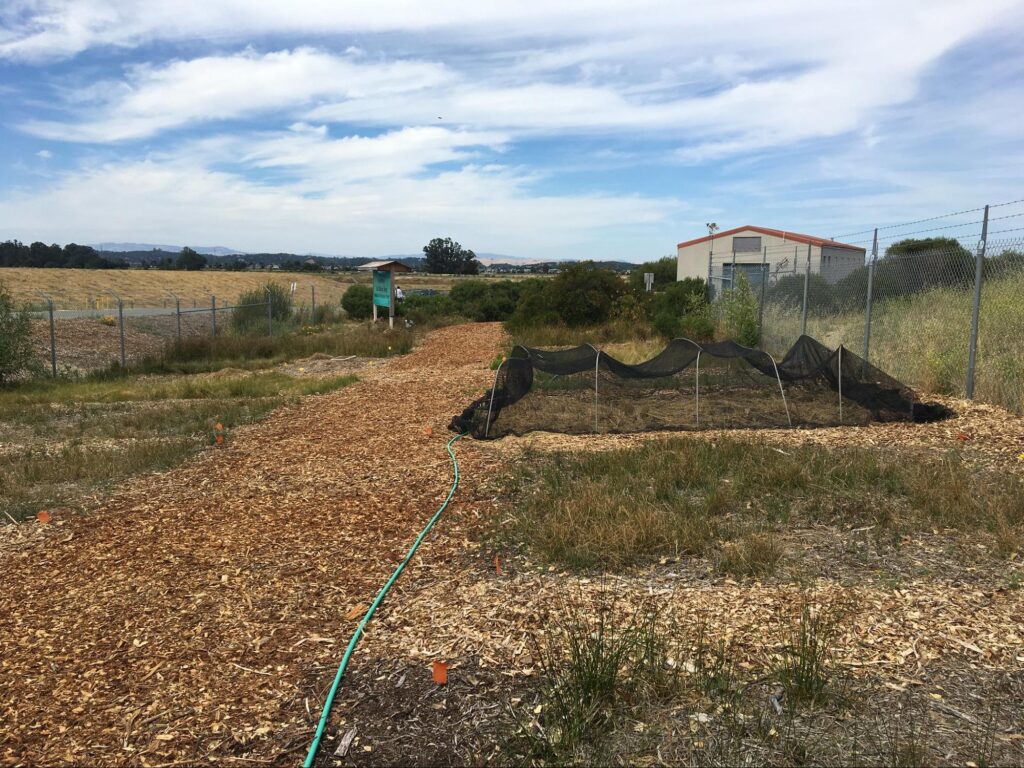
In-ground native plant propagation at Hamilton Wetlands Nursery
In 2017, the Novato Baylands Stewards joined Save The Bay in our efforts to collect and propagate native species for the Bel Marin Keys Wetland Restoration Project. Their access and knowledge of local plant populations was critical in amassing enough plant material to revegetate the seasonal wetland. Now in the second year of the outplanting phase, we are working under their lead in planting those native species across the 44-acre project site.
Save the Bay is once again proud to partner with our valued supporter Bank of America as a top-tier Bay Day sponsor for the second year in a row. Visit our 2020 blog post to check out Bank of America’s work with us in past years.
Bank of America has long been committed to environmental improvement and sustainability, having raised over $200 billion for sustainable causes by implementing green business initiatives, individual employee programs, and close collaboration with organizations like Save the Bay.
Now, they’re building on this work into the future: Bank of America recently pledged $1 trillion for sustainable development by 2030 as part of their Environmental Business Initiative. This pledge will help accelerate the global transition towards a low-carbon, sustainable economy. They have also made a company commitment of net-zero greenhouse gas emissions before 2050. Greenhouse gas emissions and the particulate matter that accompany them directly harms the Bay by polluting its air and water, and minimizing these emissions are key to the Bay’s health. To that, Bank of America’s new environmental initiatives will not only create a global sustainable shift but also directly protect the Bay and its communities for years to come.
Bank of America is not just focused on change at a corporate level, but at an employee level as well. Over the last 10 years, their My Environment Employee Program has encouraged over 24,000 employees in 32 countries to commit to sustainability. The program seeks to connect employees across the globe who share a passion for environmentalism, and empowers them by providing opportunities such as organizing beach clean ups, recycling campaigns, and sustainability webinars.
Finally, Bank of America has also gone above and beyond to support Save the Bay specifically through grants that contribute to community greening efforts and environmental education. They have also closely supported our Habitat Restoration Team, with employees making special trips to our restoration sites such as the Palo Alto Baylands, touring our native plant nursery, and restoring our site at the MLK shoreline through planting native plants and collecting invasive weeds and trash.
On both a corporate and employee level, Bank of America is dedicated to a future of sustainability, ensuring that places like San Francisco Bay can thrive and grow. To learn more about Bank of America’s environmental initiatives, visit bankofamerica.com/environment.
Brought to you by Facebook, weekly regional spotlights give an in-depth look at the Bay Area. From trails and activities to inspire your Bay Day Trail Challenge adventures, to partners and locations vital to Save The Bay’s mission of creating a healthy and resilient Bay – discover what makes our region so special, and so important to protect.
Don’t forget to follow us on Instagram and Facebook and share your adventure with #BayTrailChallenge #SFBayDay and tag @saveSFbay for the chance to win a $50 REI gift certificate every week in October.
This hiking and walking trail is a 8.6 mile point-to-point trail near Redwood City that features a river and is good for all skill levels. At the tip of the peninsula there are observation platforms to view the wetlands of the Redwood Shores Ecological Reserve. The trail also passes through the Bair Island Ecological Reserve, a 3000-acre wetland complex, and ends with a two-mile loop in Bedwell Bayfront Park. →
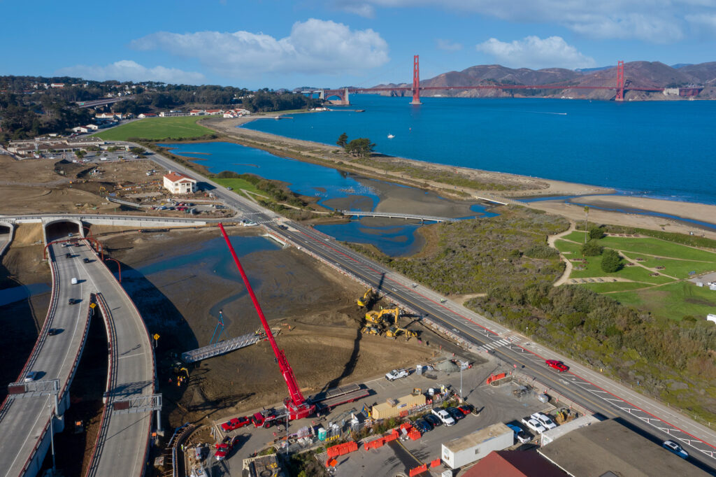
San Francisco Northern Waterfront is a 7.9 mile heavily trafficked and easy walking, running, and biking trail along the city’s waterfront. The trail begins at the iconic Fort Point under the Golden Gate Bridge and hugs the shoreline towards Crissy Field, passing restored wetlands and sand dunes. After passing through parks, harbors, and wharfs, the path reaches Oracle Park, where you can watch an inning for free from the stadium’s public viewing area. →
Check out this video to learn more about how human-driven climate change is affecting the world around us, including San Francisco Bay. →
Quartermaster Reach and the Presidio Trust
Crissy Marsh, Charity Vargas – Presidio Trust
Historically, the San Francisco peninsula did not sustain a great deal of tidal marsh habitat, but what did exist was largely altered and destroyed during the settlement and population growth of the Gold Rush era. Critical wetland restoration work, undertaken by the Presidio Trust and initiated with the renaissance of the Chrissy Marsh in the late 1990s, has reached a new phase in San Francisco.
The Quartermaster Reach project is a long-anticipated tidal marsh restoration project undertaken by the Presidio Trust, the National Park Service, and the Golden Gate National Parks Conservancy. Quartermaster Reach will restore seven acres of tidal marsh habitat adjacent to Chrissy Field. The project is the most recent piece of the multi-decade effort to restore the integrity of the Tennessee Hollow watershed, beginning with the El Polín Spring upstream and ending with output into the Bay.
In addition to planting over 20,000 native saltmarsh and dune plant species, the restoration includes habitat creation intended to support the recovery of the native Olympic oyster. The restored Chrissy and Quartermaster Reach marshes provide rich brackish habitat for numerous native bay species including migratory birds, fish, and crabs. Footbridges and trails weave above and through the restored areas along the length of the watershed allowing park visitors to get up close and personal with these well-stewarded resources.
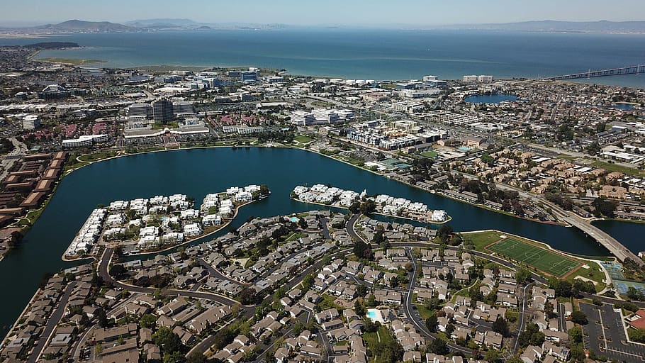
Sea Level Rise in San Mateo County
Foster City, San Mateo County
Given its location on the San Francisco Peninsula, wherever you are in San Mateo County, it seems like you’re never very far from the Bay. That’s partly what makes San Mateo County such a desirable place to live and work, but it also puts San Mateo at higher risk for future flooding due to sea level rise. In fact, San Mateo has more property (measured by value) and people at risk from sea level rise than any other county in the Bay Area. That includes regional infrastructure like the San Francisco Airport, large employment centers for some of the Bay Area’s biggest businesses, and individual homes that have been built on land that was once tidal marsh.
Luckily San Mateo County recognizes the risk and is already taking steps to make the county more resilient to climate change and sea level rise. Thanks to the strong leadership of people like Rep. Jackie Speier, Assemblymember Kevin Mullin, and Supervisor Dave Pine, in 2020 the county created the San Mateo County Flood and Sea Level Rise Resiliency District (OneShoreline). This is the first agency in the Bay Area specifically authorized to coordinate a county-wide approach to protecting people and property from future flood risk due to sea level rise.
This county-wide approach is crucial since the ability to plan and finance projects vary greatly by city, but flood protections can’t stop at the city limits. Despite being a hub for the Silicon Valley tech industry, some communities remain vastly under-resourced and vulnerable to climate change. A coordinated approach that plans projects with a regional focus is a step toward ensuring that all San Mateo County residents are protected from rising tides and that climate resilience in the county is more equitable. Hopefully, this is an approach that will be adopted by other counties around the region, allowing for a more coordinated and accelerated approach to protecting communities at risk for future flooding.
Working to Address San Mateo’s Housing Needs
The Bay Area is facing a housing crisis and needs to build significantly more housing to meet the needs of current and future residents. But where and how we build that housing is inextricably linked to our region’s approach to dealing with climate change. Save The Bay, though our Bay Smart Communities initiative, works to support housing development in ways that lessen the environmental impact of our cities, and promotes more resilient and equitable communities.
In San Mateo County, Save The Bay has partnered with the Housing Leadership Council to find ways to address these two crucial and linked needs. Over the past few years, we have co-hosted a series of workshops focused on identifying ways to meet our region’s housing needs while reducing greenhouse gas emissions, protecting people from current future flood risk, and easing development pressure along the shoreline and in undeveloped lands. Look for information on our next workshop hosted by HLC and in partnership with Greenbelt Alliance in early November.
IBM has been a long time sponsor of Bay Day for the last 4 years. 2021 is the 3rd year IBM supports Bay Day as a title sponsor.
IBM is dedicated to being a good steward of the environment and has well-established, comprehensive environmental programs and goals that help conserve natural resources and reduce our impact on biodiversity and ecosystem loss.
For example, the following four IBM sites have achieved Wildlife Habitat Council (WHC) Conservation Certifications for their wildlife habitat management and conservation education programs. This includes IBM’s two largest sites in California, which are in the Bay Area.
IBM Almaden Research Center: San Jose, California IBM Silicon Valley Laboratory: San Jose, California IBM Corporate Headquarters: Armonk, New York IBM Research Triangle Park: North Carolina
Wildlife habitat management and conservation education programs at these sites range from maintaining nesting boxes for avian species and conducting semiannual bird counts to providing pollinator-friendly habitats and organizing employee nature and species identification walks.
In continued efforts to support ecosystem diversity and well-being globally, IBM has set a goal to plant 50 pollinator gardens at IBM locations globally by year-end 2023.
An important objective of this goal is not only to plant pollinator gardens but also to engage employees to help plant and care for the gardens. In addition, IBM is committed to not only fostering site-level habitat management, but also sharing habitat management and conservation knowledge with employees. In March 2021, IBM leveraged its 30-year collaboration with WHC to develop education materials on how to create pollinator-friendly habitats and provided it to IBM employees worldwide. Employees can reference these geography-specific Conservation Pollinator Toolkits to learn what plants are suggested for their region, including planting instructions, to start their own pollinator gardens at home, in their communities or at work. Pollinators are essential for maintaining a diverse ecosystem and a simple and effective way to support pollinators is to plant appropriate flowering plants that attract and provide pollinators with the habitat resources they need.
IBM would like to share the North America Pollinator ToolKit with anyone who is interested in planting their own pollinator garden. The toolkit will help determine the plants that are best suited for the soil and climate in your area.
Brought to you by Facebook, weekly regional spotlights give an in-depth look at the Bay Area. From trails and activities to inspire your Bay Day Trail Challenge adventures, to partners and locations vital to Save The Bay’s mission of creating a healthy and resilient Bay – discover what makes our region so special, and so important to protect.
Don’t forget to follow us on Instagram and Facebook and share your adventure with #BayTrailChallenge #SFBayDay and tag @saveSFbay for the chance to win a $50 REI gift certificate every week in October.
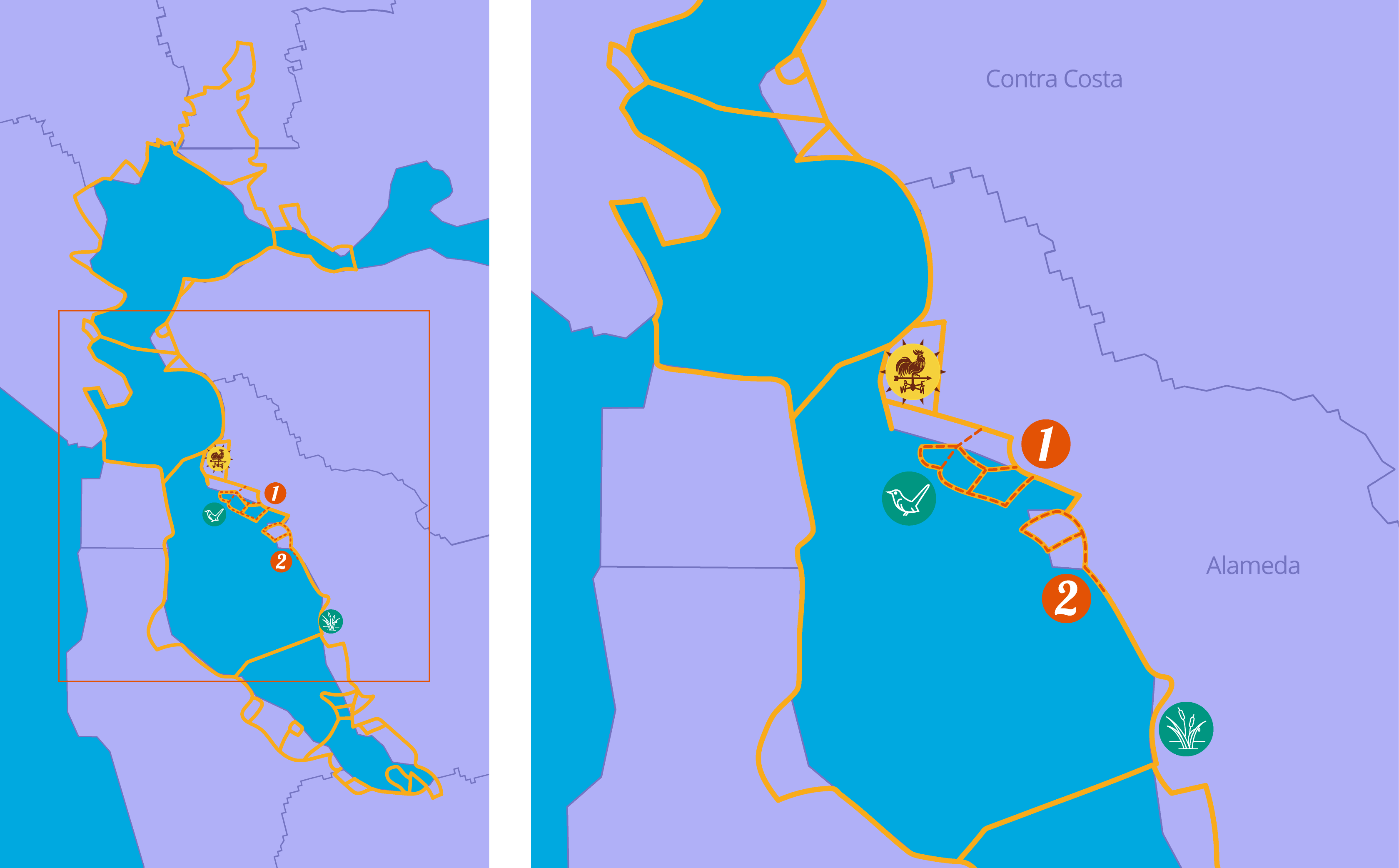
The Alameda and Oakland shorelines feature many beaches, historical sites, and nature trails, as well as the biggest active bay port. This trail begins in Alameda’s Towata Park and follows the city streets to the Oakland Waterfront Pathway, a 19-mile trail that ducks around urban areas, parks, and lakes. Smaller trails such as those between Fruitvale and High streets can be accessed via bike lanes and sidewalks along the Embarcadero. →
The trail begins on the Hayward Regional Shoreline, which is full of pickleweed marshes, seasonal wetlands, and mudflats teeming with wading birds. The trail continues into San Leandro’s shoreline park, and eventually leads to the Tidewater Boating Center, where you can watch or participate in watersports such as kayaking and boating. At the Harbor Bay Isle Ferry Terminal, catch the Alameda Bay Harbor Ferry to San Francisco or explore Bay Farm Island. →
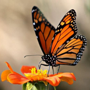
Pollinators are extremely important for the health of an ecosystem and are responsible for most of the food grown on farms. Connect with the Bay by growing plants pollinators love in your backyard. →
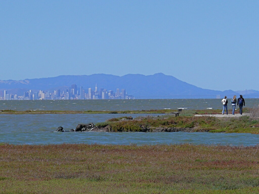
While exploring the Bay shoreline, notice all the ways that the landscape has been altered by development. In many parts of the Bay, we have built right up to the shoreline with houses, roads, and other critical infrastructure like water treatment plants. Much of this development is already in areas that are at risk of flooding, and in coming years that risk will increase and expand as sea level rise pushes the Bay shoreline upland. In an era of rising tides due to climate change, where we develop in the future and how we protect existing homes and infrastructure are some of the most pressing questions that Save The Bay is working to address.
Hayward is spearheading an approach that could serve as a model for the entire Bay Area. Earlier this year, the Hayward Shoreline Adaptation Master Plan was adopted between the City of Hayward, Hayward Area Recreation District, and the East Bay Regional Park District to prepare the area for rising tides. Importantly, this plan heavily relies on restoring tidal marsh and natural habitats and utilizes gradual sloping landscapes called ecotone levees. These types of levees absorb storm surges and allow shoreline habitat to migrate as seas rise while still providing needed flood protection for developed areas behind them.
Save The Bay has partnered with the Oro Loma Sanitary District to manage a horizontal levee that protects the wastewater treatment plant, and the concept has proven very successful. We are very excited that this plan will build on that initial pilot project, and restore several former salt production ponds into tidal marsh habitat that will also protect the surrounding community from flooding. The Hayward plan is proof that when jurisdictions work together, we can prepare our cities for sea level rise while also improving the health of the Bay, restore native habitat for endangered species, and expand recreational opportunities along the shoreline.
SF Bay Trail Birds
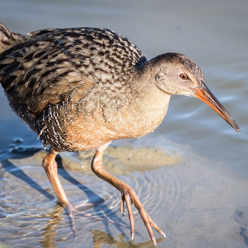
The San Francisco Bay Trail is a necklace of essential habitat for threatened bird species, including the Ridgeway’s Rail and the Western Snowy Plover. These species are both federally protected under the Endangered Species Act; cooperation between local agencies and nonprofits here in the Bay Area is imperative for ensuring their continued survival.
The Ridgeway’s Rail is endemic to the tidal marshes of the San Francisco Bay, living amongst the pickleweed and Pacific cordgrass. Its survival is put at risk by the spread of invasive and hybridized cordgrass, whose dense growth tends to clog the marsh channels that the rails rely on for foraging. Additionally, invasive predators, such as cats and rats, are a major concern.
Ridgway’s Rail
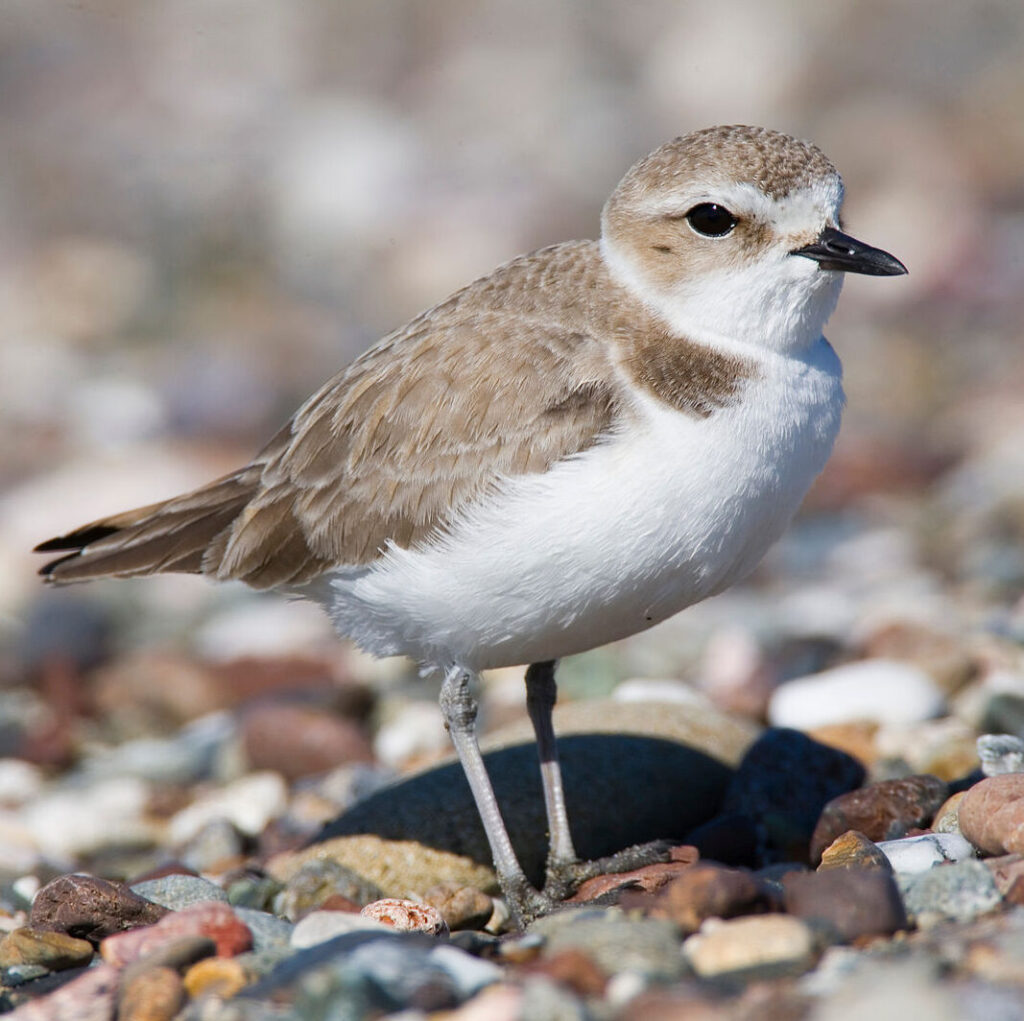
Snowy Plover
The Snowy Plovers breed on beaches and dunes up and down the West Coast, including Crown Memorial Beach in Alameda, and Eden Landing Ecological Reserve in Hayward, where Save The Bay conducts restoration. Like the Ridgeway’s Rail, the plovers are impacted by invasive species, including European beachgrass, which eliminates their nesting habitat. Both species’ critical habitats – tidal marsh and beach – have been lost due to residential and commercial development in California.
West Oakland Environmental Indicators Project’s Shoreline Academy
Every day, anywhere from 6,000 to 20,000 cars pass through the community of West Oakland. West Oakland residents, tucked in between four major Bay Area freeways, are in the 99th percentile in the State for proximity to traffic and exposure to exhaust. This is just a small piece of the unfortunate saga of environmental injustice this community has been fighting for decades. West Oakland Environmental Indicators Project (WOEIP) is an organization leading the fight for environmental justice by empowering the residents to collect, analyze, and share data about the quality of the air in their community. Owning Our Airis WOEIP’s action plan to address poor air quality with 89 strategies from expanding Asthma Management programs and air filtration systems in community centers, to biofilter design and urban canopy planning.
This summer, WOEIP launched the first Oakland Shoreline Leadership Academy, another project aimed at community-informed solutions to environmental hazards threatening West Oakland. Save The Bay is honored to be part of the curriculum by leading a seminar on habitat restoration and ecosystem services of tidal marsh. Academy members will also participate in a restoration program located on the Martin Luther King Jr. Regional Shoreline. At the end of the 6 month session Academy participants will develop a community engagement plan and shoreline improvement project. Check out how you can get involved with West Oakland Environmental Indicators Project. Get involved!
Cooley Landing Trail Loop blog was written and originally published by Environmental Volunteers. Explore more of the South Bay during your Bay Day Trail Challenge.
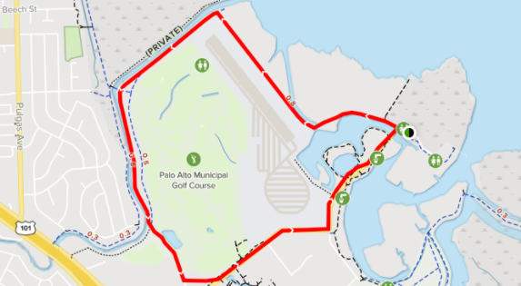
Nestled behind the Palo Alto Airport hides a gem of an outdoor opportunity for all ages; the EcoCenter in Palo Alto Baylands. This public nature center can be the jumping off point to the Cooley Landing Trail Loop.
EcoCenter in the distance
Are you an aviation buff? The Cooley Landing Trail Loop will be a sensory feast!
As you walk, bike or run the 3.2 mile trail you’ll hear the sounds of the single engine planes take off.
Airport on the left and the Bay to the right
Feel the breeze from the bay, hear the calls of snowy egrets, or be lucky enough to spot the endangered Salt Marsh Harvest Mouse. Along the way try and spot the varieties of wildflowers or get the kids, young and old involved in counting the number of different types of birds they see. When you close in on the loop don’t forget to stop into the EcoCenter during their open hours and learn even more about what you saw. This year around access, flat trail won’t disappoint!
This Bay Day Trail Challenge we encourage everyone to explore the Bay in their own way. Whether you hit the trail on your bike, jump in a kayak, or paint a picture of nature outside your door, try something different and see what you discover.
There are so many fun and free activities you can do while you explore the Bay, here are a few of our favorites.
Picnicking
Pack a lunch, grab some friends and family and adventure to one of these beautiful areas for a picnic along the Bay Trail! Be sure to pick up all of your trash-and even better, try to pack a zero waste lunch!
Exploring Art
Along the Bay Trail, you may find some public art installations. See if you can find some of the art installations along the trail. Get inspired by these artists and your surroundings and draw or paint what you see!
Birding
Grab your binoculars, cameras and local birding guide to quietly observe the diverse bird populations around the Bay! You can go birding anywhere along the Bay Trail, but here are some of the more popular spots.
Skating & Rollerblading
Some paths of the Bay Trail are paved or alongside roads. Check out the Bay Trail Map to see which sections are suitable for wheels.
Did you know there is a Water Trail in the San Francisco Bay? This trail has no beginning or end and is instead a network of launching/landing sites. Grab your canoe, dragon boat, kayak, kiteboard, rowboat, or paddleboard! Learn more about the SF Bay Water Trail here.
Walking and Running
With over 500 miles of trail around the Bay, there are many trails for walking and running! Bring your dog and enjoy a walk along the Bay. Lace up your tennis shoes and check out the Bay Trail Map to find your next adventure!
Cycling
All the trails along the San Francisco Bay Trail are multi-use, keep your eye out for pedestrians and other cyclists! Check out some popular cycling routes along the Bay Trail. Teach your kids how to ride a bike, enjoy a bike ride with friends and family, or enjoy some time to yourself along the beautiful Bay.
Bay Day Trail Challenge Tips
Use AllTrails
Download the AllTrails app to discover and explore new trails near you. You can search by activity or on the map and read tips and reviews of the trail before you head out.
Share your Adventure
Don’t forget to follow us on Instagram and Facebook and share your adventure with #BayTrailChallenge #SFBayDay and tag @saveSFbay for the chance to win a $50 REI gift certificate every week in October.
This year, Facebook has strongly demonstrated its support for Save The Bay’s mission by becoming one of the title sponsors for our 6th Annual Bay Day. The tech company that makes the Bay Area its home has sponsored the event every year since its inception and also engages in ongoing partnerships with other outstanding local organizations that are focused on endangered species protection efforts.
The SFBBO has combined science and outreach for 40 years to conserve birds and their habitats and protect endangered species in the marshland—the crucial area where Save The Bay also focuses our restoration work. The SFBBO maintains a particular focus on helping protect the Snowy Plover, and also aids the Ridgway’s Rail and salt marsh harvest mouse.
Snowy Plover
Ridgway’s Rail
Salt Marsh Harvest Mouse
Facebook recently supported one of the SFBBO’s exciting new programs, the Pacific MOTUS Tower Network, which uses an automated radio technology to allowthe scientific community to track migrating birds. SFBBO Executive Director Yiwei Wang explains that MOTUS can track species between Bay Area sites… “and also between important migratory locations throughout the West Coast as more Motus towers get added.”
Facebook supports this project that aims to protect gray foxes in the Palo Alto Baylands—an area important to Save The Bay’s work as well—and to document their behavior in order to establish healthy habitats and develop the biodiverse wildlife corridors necessary for their survival. Some of these foxes even live among Facebook’s on-campus green spaces, having found their way up there from the neighboring Baylands!
In addition to these partnerships that build on Facebook’s longstanding commitment to the environment, the company implements sustainability measures in its operations. Last year, the company achieved net zero emissions (100% renewable energy) in its global operations, and recently committed to being water positive by 2030 (they will restore more water than they consume).
To view Facebook’s Sustainability Report, and learn more about their focus areas—Climate, Energy, Water, Biodiversity, and Responsible Supply Chain—visit sustainability.fb.com.
Brought to you by Facebook, weekly regional spotlights give an in-depth look at the Bay Area. From trails and activities to inspire your Bay Day Trail Challenge adventures, to partners and locations vital to Save The Bay’s mission of creating a healthy and resilient Bay – discover what makes our region so special, and so important to protect.
Don’t forget to follow us on Instagram and Facebook and share your adventure with #BayTrailChallenge #SFBayDay and tag @saveSFbay for the chance to win a $50 REI gift certificate every week in October.
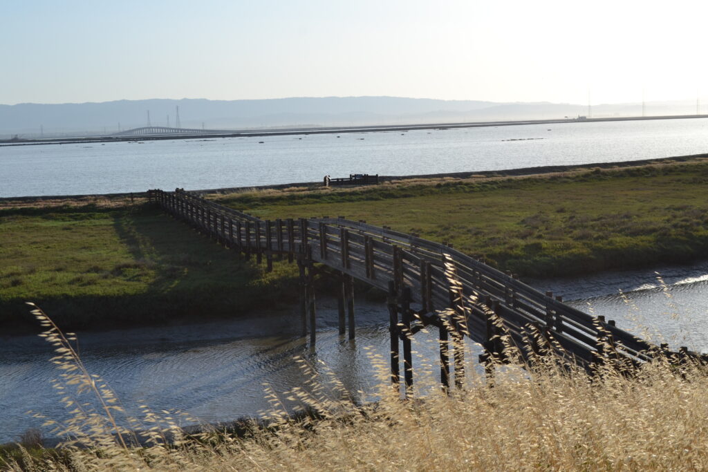
This trail begins at Bedwell Bayfront Park, heading southward into the Don Edwards San Francisco Bay National Wildlife Refuge and finishing at Alviso Marina County Park. From here you can explore the Ravenswood Open Space Preserve, discover the Lucy Evans Baylands Nature Interpretive Center, and visit the nearby Sunnyvale Baylands Park which features seasonal wetlands and grassy uplands that are great for picnicking. →
Alviso is a historic waterfront town in the city of San Jose, located at the southernmost part of the Bay. The former marina has been restored back into wetlands and houses a variety of trails. As you explore you can see wetlands, brackish and freshwater marshes, and salt ponds. The nearby Environmental Education Center off of Grand Boulevard exhibits some interpretative displays of wetland wildlife and has its own 4.5 mile loop trail surrounding a restored salt pond. →
Learn more about the wildlife that you can find in the Bay Area through Save The Bay’s Summer Camp activities.
Summer camp activities are a part of OLO: Outdoor Learning Online, Save The Bay’s education portal that offers hands-on science lessons for remote learning environments.
South Bay Shoreline Study
The South Bay has some of the most incredible access to the Bay shoreline, as the Bay Trail snakes along the levees ringing former salt production ponds that now comprise the Don Edwards National Wildlife Refuge. Many of the ponds just north of San Jose are also part of an ambitious flood protection and habitat restoration project called the South Bay Shoreline Study. Despite its unassuming name, the Shoreline Study is a critical component of the South Bay’s future flood protection from storms and sea level rise. Many of the surrounding communities, particularly Alviso in San Jose, are subject to flooding, and with sea level rise the risk from the Bay is increasing.
Don Edwards San Francisco Bay National Wildlife Refuge
The Shoreline Study will build new levees and restore nearly 3,000 acres of former salt ponds into tidal marsh and other natural habitat to buffer Alviso and North San Jose from the Bay’s rising waters. Together with the larger South Bay Salt Ponds Restoration Project, the largest tidal wetland restoration project on the west coast, these two efforts will remake the area’s landscape to provide habitat for endangered species, flood and storm surge protection for residents, water quality improvements for the Bay, and more recreational access for people to experience and enjoy the natural landscape of our region.
With sea level rise from climate change already staring to show impacts locally, this is exactly the type of nature-based, multi-benefit climate infrastructure that Save The Bay works to support. In 2016, we led the campaign to pass Measure AA, a $500 million parcel tax that voters backed overwhelmingly to fund these types of restoration projects. That investment has already been put to work providing significant funding for the Shoreline Study, along with large contributions from the federal government, State Coastal Conservancy, and Valley Water. Save The Bay will continue to advocate for additional state and federal funding to accelerate these types of restoration and flood protection projects to keep our communities out of the reach of rising tides.
Making our Cities Resilient: San Jose Urban Greening
A day out walking along the Bay provides significant mental and physical health benefits. Unfortunately, the same isn’t always true within our cities where streets are built to prioritize traffic efficiency over pedestrian safety, and urban environments are dominated by hardscape rather than vegetation and natural features. In fact, walking or biking around many cities can be downright dangerous, especially in neighborhoods that have experienced historic patterns of disinvestment and lack access to political and economic power, which often fall along racial lines.
Climate change is making this situation worse. As average temperatures increase, areas without tree canopy and vegetation experience even higher heat – a situation called the “urban heat island” effect. Trees and other plants can help reduce the ambient air temperature in cities by up to 10 degrees, and pervious surfaces like tree wells, planter boxes, and bioswales can absorb and filter rainfall from the more intense storms that are predicted to occur. Doing so relieves pressure on stormwater systems that can get overloaded and lead to flooding, and stormwater filtered through these types of “green” infrastructure is cleaner – improving water quality in the Bay.
San Jose
In San Jose, Save The Bay has been working over the past few years to prioritize equitable investment in “urban greening”, including expanded tree canopy, green streets, and other nature-based features. By doing so, we can make our communities more resilient to climate change and improve water quality in the Bay. If done as part of pedestrian-focused street redesigns, we can also ensure that our streets are safer, more appealing places for people.
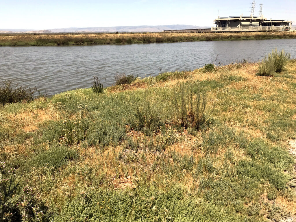
A Long History of Restoration In Palo Alto
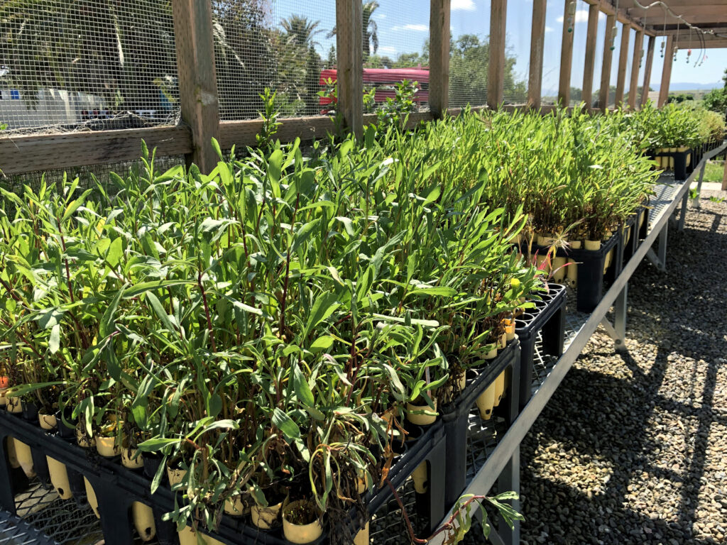
Save The Bay has worked in collaboration with the City of Palo Alto in the Baylands for over 20 years, initially establishing a restoration site at the mouth of San Francisquito Creek in 2001.That first season, we held 8 programs and planted over 10,000 plants grown by an outside native plant nursery contractor. In 2004 and with much celebration and fanfare, the City constructed the nursery shadehouse structure we still use today to grow our plants. Over the past two decades, the Baylands have been the site of innumerable education and community-based programs. We join together with the City of Palo Alto staff to restore the shoreline and educate the public about the importance of these critical tidal marsh habitats. This partnership not only gives us a home base from which to conduct our restoration and education work but provides vital support to both parties.
Restoration at the Palo Alto Baylands
Nursery shadehouse
In the next few years, Save The Bay hopes to take our work with the City of Palo Alto even farther. We’ll apply what we’ve learned from our work on the Oro Loma Horizontal Levee demonstration project and apply it to similar multi-solution green infrastructure projects around the bay. A local example of this is the planned Palo Alto Horizontal Levee Pilot Project, undertaken by the City of Palo Alto, ESA, the SF Estuary Partnership and the EPA. Gently sloping, vegetated horizontal levees, like those designed in these two projects, generate greater benefits than a traditional hardened shoreline levee. They provide healthy, native transition-zone habitat, improve water quality, and serve as shoreline and flood protection in the face of sea level rise.
Meet the Environmental Volunteers
Environmental Volunteers (EVols) is an organization with a longstanding relationship to the Palo Alto Baylands and a mission similar to that of Save The Bay. Since 1972, EVols has provided hands-on science learning to students throughout the South Bay and strives to generate lifelong stewards of the natural world. The organization is housed in a unique building originally constructed in 1941 for the Sea Scouts program’s use in launching boats into the adjacent Palo Alto Harbor. In 1986, the City of Palo Alto chose to close the frequently dredged harbor, allowing it to return to its natural state of tidal marsh wetland. Today, the Baylands tidal marsh and transition zones are lush and verdant, providing critical habitat for migrating waterfowl and endemic species like the elusive Ridgway’s Rail.
Building on Facebook’s ongoing dedication to fighting climate change and their commitment to Bay Day as a title sponsor this year, they recently partnered with Midpeninsula Regional Open Space District to support a crucial effort to improve access to the San Francisco Bay Trail. This trail system is a central focus of Save The Bay’s 6th Annual Bay Day, and is planned to eventually include 500 miles around the Bay. Currently, 350 miles are in place and expansion continues as gradually the gaps between segments are filled in.
One such gap is the Ravenswood Bay Trail Connection, in East Palo Alto (near Facebook’s campus and one of Save The Bay’s habitat restoration sites). Closing this gap was a priority since it opened 80 miles of continuous Bay Trail, connecting to Menlo Park to the north, the Santa Clara area to the south, and across the Dumbarton Bridge to the East Bay. Completed in 2020, the new segment enables more people to commute by bicycle and offers new options for recreation.
Facebook has been instrumental in ensuring this vision will become a reality—one that will connect more Bay Area residents now, and far into the future, with the natural environment and with our spectacular Bay.
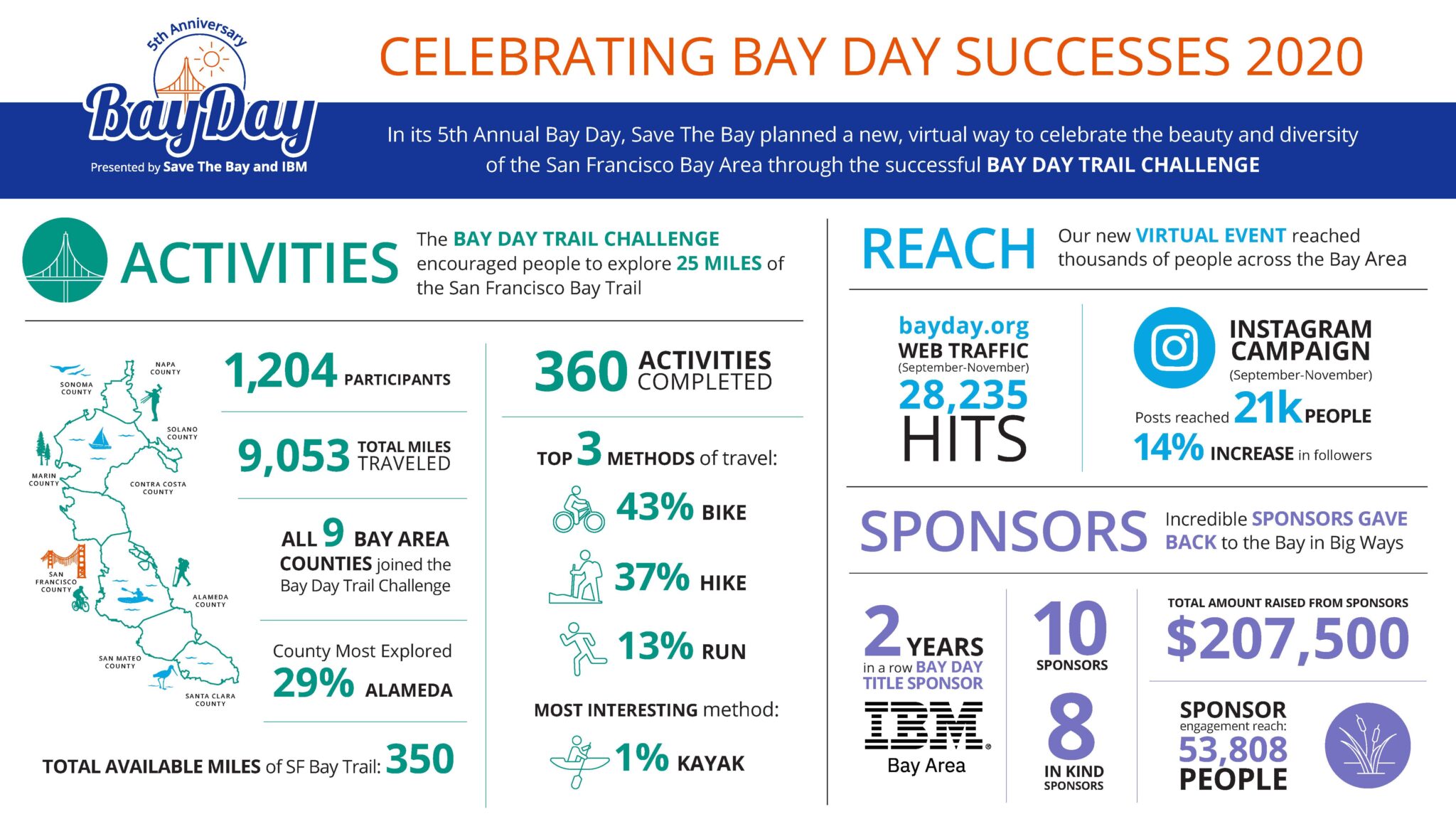
In 2020, Bay Day brought over a thousand people from around the Bay Area to the shoreline to explore and celebrate San Francisco Bay. Together, we covered over 9,000 miles of Bay Trail and completed 360 activities. We look forward to going even farther in 2021.